|
Cassini
Maps |
15
High Street, Upton upon Severn |
First published between 1880 - 1910 (Incomplete coverage - maps missing in Norfolk and Yorkshire)
 |
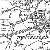
The origins of the six inch to the mile (1:10,560) maps date back to
1824 when this scale was adopted for a survey of Ireland. By 1840
it had been decided to extend the project to Great Britain. Work
began in Lancashire and Yorkshire in 1841 and in Scotland in 1843 with
the first sheet appearing in 1846.
It was not until 1890 that maps covering the whole country had been published, a family of maps that later became known as the County Series. By that time revisions to the earlier sheets were underway, a rolling process that continued until the last County Series sheets were |
| superseded
by the 1:10,000 National Grid Edition in the 1980s. Each sheet
appeared in up to six editions, displaying various evolutions of detail,
format and reproduction technology.
For over a century, Ordnance Survey's County Series maps reveal the changing face of Britain in compelling and painstaking detail and now provide immaculate records for 21st-century researchers and historians. |
|
 |
ORDER
ONLINE
We
are now taking payments using |
 |
